NOAA Forecast Aurora in Eight States, but Only Northern Alaska Had High Odds
An aurora forecast can cover a wide area without giving everyone inside it the same realistic chance of seeing the sky light up. NOAA’s Space Weather Prediction Center placed eight states within a two-night northern-lights footprint for Tuesday, Sept. 8, and Wednesday, Sept. 9, but the outlook sharply favored northern Alaska.

Alaska, Idaho, Minnesota, Montana, North Dakota, South Dakota, Washington and Wisconsin were included. Northern Alaska had a high likelihood of seeing the aurora, while the states on or near the U.S.-Canadian border had only a low likelihood. Most of Canada also fell within the high-likelihood area. The year was not specified in the forecast account, and the Sept. 8-9 viewing window has passed, so it should not be treated as a current opportunity.
A broad footprint did not mean equal viewing odds
The contrast matters because a state appearing on an aurora map can sound more definitive than it is. In this case, the forecast’s geographic reach extended into several northern-tier states, potentially putting the phenomenon within reach of millions of residents. Yet the practical probability remained much stronger at the northern end of the footprint.
That difference reflects how aurora forecasts describe a phenomenon that varies with latitude and changing space-weather conditions. The eight-state list established where visibility was possible during the forecast window; it did not establish that the entire state, or every observer in it, had comparable odds. A low chance near the Canadian border remained meaningfully different from the high chance assigned to northern Alaska.
The distinction is especially important for large states. Inclusion at the state level is a convenient way to communicate public reach, but it lacks the precision needed to judge conditions at a particular town or viewing site. The information provided for the Sept. 8-9 outlook did not specify viewing hours, a geomagnetic-storm rating or an expected southern visibility boundary.
Space weather creates the display, but local weather can hide it
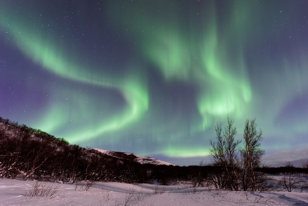
Auroras begin with charged particles carried through space by the solar wind. Solar activity, including solar flares and coronal mass ejections, can contribute to these particle flows. When charged particles enter the region controlled by Earth’s magnetic field and reach the upper atmosphere, collisions with oxygen and nitrogen produce visible light. NASA describes the resulting displays as moving “ribbons” of differently colored light.
That mechanism explains why NOAA monitors activity beyond Earth to produce public aurora forecasts. It also explains why those forecasts can change: the relevant particle environment and its interaction with Earth’s magnetosphere are dynamic rather than fixed. An archived two-night footprint therefore says what forecasters considered possible for that period, not what will happen during a later night.
Even a favorable space-weather outlook is only one part of the viewing equation. The sky must also be dark enough, and clouds can block the display regardless of auroral activity overhead. The Sept. 8-9 account did not provide cloud conditions, so it cannot establish what observers actually saw in any of the listed states.
For a future attempt, viewers need to compare NOAA’s latest aurora forecast with current local cloud and visibility data rather than rely on the archived state list. NOAA’s Graphical Forecasts for Aviation tool displays cloud cover, ceilings, visibility, precipitation and other weather layers across the United States and beyond. It is built for aviation weather awareness, but its cloud information can help show whether the atmosphere is likely to obstruct the sky at a given location.
The Sept. 8-9 forecast was notable for its eight-state reach, but its probability pattern carried the more useful message: northern Alaska had the strong opportunity, while the border states were on the low-odds edge. Any new aurora window requires a new comparison of space weather, darkness and clouds before that broad footprint becomes a practical night-sky plan.
| More aerospace and engineering stories, right in your MSN feed. Follow AMI on MSN |
By David Whitaker — Associate editor for AMI’s aerospace and drone systems desk, translating flight systems, aircraft programs, spaceflight, and UAV developments into accessible technical stories.