Iran Launch-Site Image Hinted at Secret U.S. Satellite Imaging Detail
A remarkably detailed image of an Iranian rocket launch site, publicly shared by President Donald Trump in August 2019, offered an unusual glimpse of possible U.S. reconnaissance capability. The picture showed damage at the Semnan facility with substantially more detail than commercial images available at the time, but its source was never officially established as a satellite rather than an airborne platform.
The distinction limits what can be learned from the disclosure. Contemporary reporting described the picture as apparently originating from a classified U.S. satellite or drone, while noting that it appeared to be a photograph of another display or print. That added an uncontrolled step between the original data and the public copy: reflections, cropping, resizing and display quality could all affect an analyst’s estimate of the underlying sensor performance.
The image therefore provided a clue, not a specification sheet. No verified ground-resolution figure accompanied it, and one processed picture cannot establish the smallest object a sensor can reliably distinguish across its operating range.
Why one sharp picture cannot define a satellite
“Resolution” is often treated as a single number, but orbital imaging performance depends on more than pixel size. According to NASA’s Earth-observation guidance, datasets have spatial, temporal, spectral and radiometric resolution. The spacecraft’s orbit and instrument design also shape the result.
For an optical system, image quality can vary with altitude, viewing angle, atmospheric conditions, illumination, focus, platform stability and processing. A narrow view collected under favorable conditions may look far better than an image taken at a steep angle or through haze. Sharpening and contrast enhancement can make boundaries easier to interpret without creating genuinely new spatial information.
The 2019 picture showed that a U.S. government system could produce a highly informative view of the launch site under those particular conditions. It did not reveal the sensor’s complete field of view, revisit rate, spectral coverage, low-light performance or normal operating resolution. Nor did it establish an ability to identify and continuously follow individual people.
Commercial imagery supplied the comparison
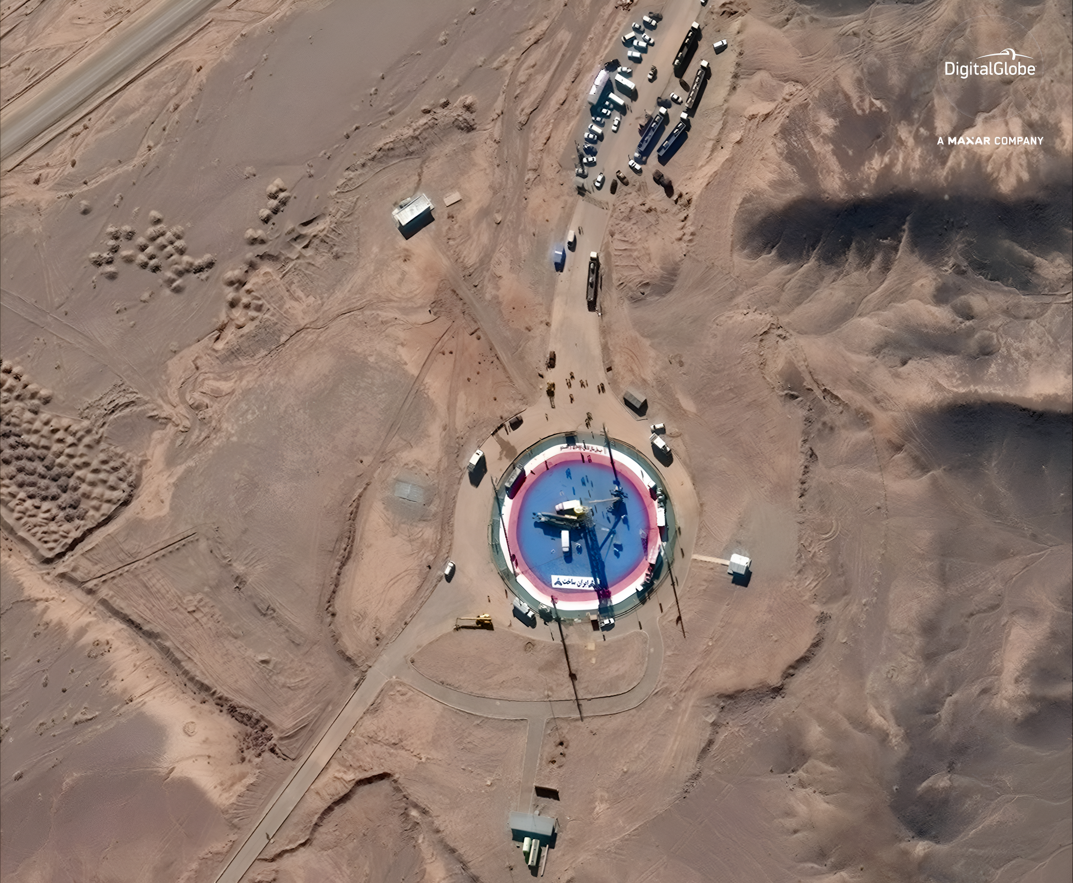
Commercial satellites had already detected the apparent launch-pad accident. Planet imagery showed a smoke plume, while a higher-resolution Maxar image presented more detail. At the time, Planet’s Dove satellites were described as resolving features at roughly 3 meters, or about 10 feet, while Maxar’s WorldView-2 offered resolution around 46 centimeters, or 18 inches.
The government image appeared significantly sharper than those commercial products, which is why its publication attracted attention. Yet the comparison was not a controlled test. The images came from different instruments, viewing geometries and times, and the publicly circulated government picture was not necessarily a raw, full-resolution product.
Commercial constellations also buy a different advantage: coverage and frequency. A fleet of smaller spacecraft can repeatedly scan broad areas and flag changes, while a larger narrow-field instrument may be tasked for a more detailed look. The 2019 episode illustrated how those layers can complement each other. Commercial imagery first made the launch-site event public; the government picture then showed what a more specialized collection could potentially add.
Optical detail is only part of orbital observation
Optical cameras depend on reflected light and can be obstructed by clouds. Synthetic-aperture radar follows a different design path, transmitting radio energy and processing the returning signal to form an image. NASA notes that radar imaging can operate day or night and through adverse weather, although radar products do not resemble ordinary photographs and require specialized interpretation.
That tradeoff matters beyond intelligence work. Earth-observation systems support wildfire assessment, hurricane monitoring, agriculture, climate research and disaster response. Higher resolution can reveal smaller changes, while frequent coverage can show how conditions evolve. Those same improvements expand the ability of governments and commercial operators to observe human activity, keeping privacy concerns attached to advances in sensor design and data processing.
The contrast with early reconnaissance hardware is stark. The National Reconnaissance Office’s declassified history of Corona explains that the first successful mission in August 1960 physically returned 3,000 feet of exposed film. Early Corona cameras produced imagery with roughly 40-foot ground resolution; later versions improved that figure to about 5 to 7 feet.
Modern spacecraft transmit digital data instead of waiting for a film capsule to return to Earth. The 2019 Iran image demonstrated how far that chain had advanced, but it exposed only its final output under one set of conditions. The sensor, orbit, processing pipeline and repeatable performance the details needed to define the system remained outside public view.
| More aerospace and engineering stories, right in your MSN feed. Follow AMI on MSN |
By David Whitaker — Associate editor for AMI’s aerospace and drone systems desk, translating flight systems, aircraft programs, spaceflight, and UAV developments into accessible technical stories.